With the weather window of opportunity opening for just a single climbing day and considering myself in good shape,
I was up for a demanding single-push trip with good panoramic views. I made the decision to climb either Eldorado or Snowking,
depending on whether I'd be lucky to find climbing partners on the spot.
Taking advantage of my jet lag (having arrived from Germany the day before), I left Issaquah at 3:30 AM and drove to the
Eldorado trailhead on the Cascade River Road. Around 6 AM, a dozen cars were parked there, but I did not find a
party that I might have joined. So I chose Snowking because, at least on the Kindy Ridge Route, its glacier can be
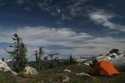
avoided such that going solo is safe. Due to its remote and lengthy access, one may easily be in entire solitude all day;
it was not before my way out when I met a handful of other people.
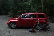
Having read in Selected Climbs in the Cascades: Volume 1
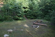
about the bad condition of the access road, I brought a mountain bike in order to cut a bit of time on
the approximately 80% of the Kindy Creek Road (FR-1570) which had become unusable even for high-clearance cars.
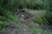
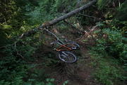
Even with the bike, using the abandoned logging road was not strictly fun because of a good handful washouts in its
lower section and numerous fallen trees blocking the road in particular in its upper sections, such that I had to push
- or sometimes even carry - the bike over these. Nevertheless, on the way down the bike proved to be convenient.
Another issue of the Kindy Ridge Route is route finding: on the way up I missed the turnoff to Point 5791.
The said book incorrectly states: Soon a boggy area is reached, with a tent spot nearby (approximately 4,800 feet), where the trail fades. The climbers track ascends from behind some boulders and proceeds steeply upward to the southwest. There may be a trail junction at approximately 5,200 feet; the fishermans trail descends to the west toward Found Lake; the climbing path continues up (south) to Point 5791, .... It should better read as: Soon a boggy area is reached, with a tent spot nearby (approximately 4,800 feet), after which the trail bears left and descends slightly. There is a trail junction at approximately 5,200 feet; the fishermans trail descends to the west toward Found Lake; instead make a left where the climbing path proceeds steeply up (south) to Point 5791, ....
When I noticed that I was on the fishermans trail towards Found Lake, I continued cross-country and by-passed Point 5791
on rather steep and overgrown terrain. On the way back from Cyclone Lake to Point 5791 I had a similar problem,
such that in the whole I needlessly lost more than one hour and precious forces. Maybe I'm just spoilt with the well managed
trails in the Alps, which are clearly marked in virtually all available maps and are well sign-posted at critical turnoffs,
but here maybe this is done differently on purpose, namely to retain a flavor of wilderness.
A further issue of the Kindy Ridge Route is that is includes a couple of ups and downs,
which add about 900 ft of extra elevation gain/loss.
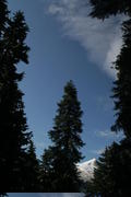
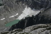
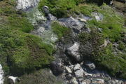
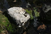
Due to vegetation there is nearly no views on the lower half of the trail, and the only really nice part of the route
is the area around Cyclone Lake. Once having passed it, the final ascent is just a matter of about two hours.
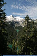
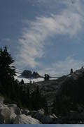
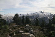
The views from the top are the really rewarding thing about this mountain: basically all the good Northern Cascades
friends greet you, from Rainier in the south over Forbidden in the east to Baker in the north, and many others in between.
On the way down I partially was able to slide the snow fields at the southeastern fringes of Snowking Glacier,
but with care in order to avoid steep sections and potentially hidden crevasses.
Altogether, it took me 13 hours car to car,
and I was not 100% satisfied because I was too late at the summit to get clear (haze-free) views.
If I ever do this mountain again, I'd choose a different approach, presumably the Northwest Route, car-camp, and start climbing way before sunrise, as I did on Sahale Peak.
| Forest Road 1570
| 
Road blocked
| 
washouts
| 
fallen trees
| 
cutout and former trailhead
|
|---|
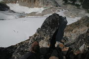
| Ascent bypassing Point 5791
| 
| 
| 
| 
|
|---|
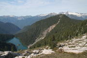
| Around Cyclone Lake
| 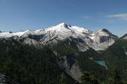
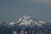
Snowking Mountain
| 
| 
Eldorado Peak
| 
Forbidden Peak, Sahale Peak to its right
|
|---|
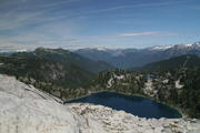
Cyclone Lake
| 
|
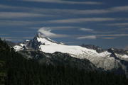
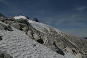
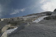
| Final ascent on Kindy Ridge
| 
| 
| 
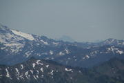
Glacier Peak
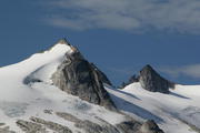
| 
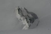
small summit pyramid
|
|---|
| On the summit
| 
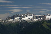
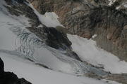
| 
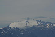
Snowking Glacier
| 
| 
|
|---|
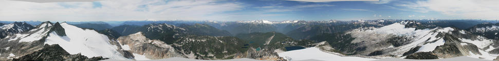
360° panorama
|
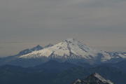
Mount Baker
| 
Mount Shuksan
| 
Mount Stuart
| 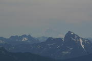
Mount Rainier
|
| Descent to Cyclone Lake
| 
| 
| 
| 
|
|---|
| 
| 
| 
|
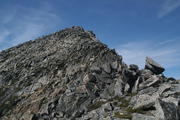
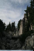
| Traversing Point 5791
| 
Found Lake
| 
Found Lake
| 
| 
last view back
|
|---|
URL: http://David.von-Oheimb.de/gallery/Snowking/index.html,
Last modified: Sat Oct 4 10:32:33 PDT 2008